Rannoch Moor Wild Camping Map: Finding Dry Ground on the Bog
Rannoch Moor is 130 square kilometres of peat bog and lochan. A guide to finding dry ground, the two railway stations, and camping somewhere this exposed.
Rannoch Moor Wild Camping Map: Finding Dry Ground on the Bog
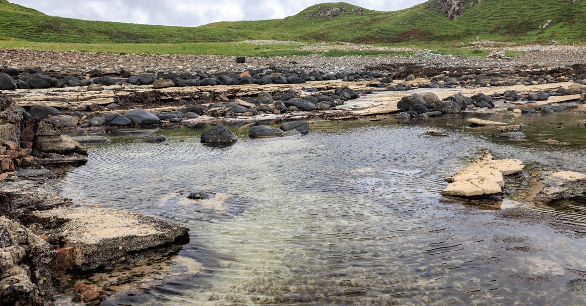
Rannoch Moor is the emptiest large space in Britain that you can reach by train. Roughly 130 square kilometres of blanket peat, lochan and granite between Glen Coe and Bridge of Orchy, crossed by one road, one railway and the West Highland Way, and otherwise almost entirely untracked. Camping here is less about choosing a view than about finding somewhere that is not a bog. This guide is based on desk research: the Scottish Outdoor Access Code, ScotRail timetables, West Highland Way material and Ordnance Survey mapping rather than first-hand testing. Below you will find the access points, how to read the ground for a dry pitch, and why this place punishes casual navigation.
Quick Reference
| Access point | Character | Notes |
|---|---|---|
| Rannoch station | Rail, road from the east | Road ends here; the moor starts at the platform |
| Corrour station | Rail only, no public road | Britain’s highest mainline station |
| Kingshouse / Glen Coe | A82, west edge | Busiest end; West Highland Way passes |
| Bridge of Orchy | A82, south edge | Way-marked route north across the moor |
The Legal Position
The Land Reform (Scotland) Act 2003 makes responsible wild camping a statutory right across most of Scotland, and Rannoch Moor is not subject to camping byelaws — those apply only to seasonal zones in Loch Lomond and The Trossachs National Park, which is a different park to the south.
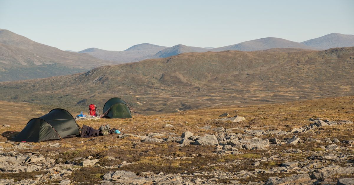
Responsible under the Scottish Outdoor Access Code means small tent, one or two nights, carried in on foot, away from buildings and roads. On the moor the second part is easy; the first is the hard bit, because there is nowhere sheltered to be small and unobtrusive.
Getting There
By train. This is the moor’s distinguishing feature. The West Highland Line crosses it, with stations at Rannoch and at Corrour — the highest mainline station in Britain, and one with no public road access at all. Stepping off a train into open moorland with no road in any direction is a genuinely unusual way to start a trip, and it removes the car-shuttle problem entirely.
By road. The A82 skirts the western edge past Kingshouse and Glen Coe. A single minor road runs west from Pitlochry along Loch Rannoch to Rannoch station and stops.
On foot. The West Highland Way crosses the south-western moor between Bridge of Orchy and Kingshouse, and is the way most people experience it.
Finding a Dry Pitch
This is the whole skill here, and it is worth more than any gear choice.
Read the vegetation. Bright green sphagnum is standing water with a lid on it. Heather and dwarf shrub indicate ground dry enough to support them. Deer grass and cotton grass mean wet. If it looks like a lawn, it is a bog.
Look for the raised ground. Glacial moraine mounds, the drier lips above lochan outflows, and the granite knolls that break the peat are where the dry pitches are. They are small — often only big enough for one or two tents — so start looking earlier than you think.
Near the railway or the Way, go further. The obvious flat spots close to infrastructure are both busiest and, being flat, usually wettest.
Take the wind into account. The moor is enormous and there is essentially nothing to break the wind. A slight hollow behind a knoll is worth a great deal, but avoid actual depressions — they collect both cold air and water.
Pegs. Peat holds pegs badly. Long pegs, or rocks, and expect to re-tension in the night.
Where to Head
Around Loch Laidon. The large loch running north-east from near Rannoch station. Shoreline knolls give some of the better ground on the moor, and the outlook is superb.
Between Corrour and Loch Ossian. Slightly higher, better drained, with some planting near the loch. The most forgiving ground in the area and a sensible first night.
The Blackwater Reservoir area. Northern edge, remote and rarely visited, with the dam and the Kinlochleven hills beyond.
The Bà bridge area on the old military road. Near the Way, with the Black Mount hills rising to the west. Popular for good reason, so expect company in season.
The Black Mount fringe. Where the moor meets the hills at its western edge — better drainage, more shelter, and the best views back across the bog.
Why It Is Harder Than It Looks
Navigation is genuinely difficult. The moor is nearly flat and almost featureless, with hundreds of near-identical lochans. Contours give you very little. In mist it is one of the most confusing places in Scotland, and a GPS is close to essential alongside map and compass.
Distances deceive. Cross-country movement over peat hags and bog is slow — expect a fraction of your normal pace off the paths. Plan by time, not by kilometres.
Water is everywhere and mostly peat-stained. Brown water is not necessarily unsafe but it tastes of the moor. Take from running burns where you can and filter or treat.
Weather is unbroken. No shelter, nowhere to hide, and it catches everything coming in off the Atlantic. This is a place to have confidence in your tent.
Midges are severe from late May to September in the still, damp conditions the moor specialises in. A breeze is your friend here; a calm evening by a lochan is not. Ticks are present in the longer grass at the fringes.
Responsibilities
- Toilet waste buried at least 30m from water — harder than usual in saturated peat, so carrying out is often the honest answer.
- No open fires. Peat can burn underground for weeks. This matters more on Rannoch Moor than almost anywhere in Britain.
- One or two nights, then move on. The vegetation is thin and slow to recover.
- Everything out, food waste included.
FAQ
Can you wild camp on Rannoch Moor? Yes. Scotland’s Land Reform Act 2003 makes responsible wild camping a statutory right, and there are no camping byelaws on Rannoch Moor. Follow the Scottish Outdoor Access Code — small tent, one or two nights, well away from the road and the stations — and you are within your rights.
How do you find a dry place to camp on Rannoch Moor? Read the vegetation: heather and dwarf shrubs mean ground dry enough to support them, while bright green sphagnum, cotton grass and anything resembling a lawn mean standing water. Head for glacial moraine mounds, granite knolls and the raised lips above lochan outflows. Dry pitches are small, so start looking well before you want to stop.
Can you get to Rannoch Moor by train? Yes, and it is the best way. The West Highland Line crosses the moor with stations at Rannoch and at Corrour, the highest mainline station in Britain and one with no public road access. You can step off the train straight onto the moor, which removes any need for a car shuttle.
Is Rannoch Moor dangerous? Not in the mountaineering sense — it is nearly flat — but it is easy to underestimate. It is almost featureless with hundreds of similar lochans, so navigation in mist is genuinely hard, cross-country travel over peat hags is very slow, and there is no shelter from weather anywhere. Carry a GPS as well as map and compass, and plan by time rather than distance.