The Best Wild Camping Kit for the Cheviot Hills in 2026
The Cheviot Hills form the wildest corner of northern England — a rolling, treeless massif straddling the Scottish border where the Pennine Way crosses…
The Best Wild Camping Kit for the Cheviot Hills in 2026
The Cheviot Hills form the wildest corner of northern England — a rolling, treeless massif straddling the Scottish border where the Pennine Way crosses some of the most exposed moorland in the country. Wild camping here is a different proposition from a weekend in the Lakes or the Dales: there is almost no natural shelter, the weather turns without warning, peat hags swallow boots to the knee, and a legal boundary runs straight through the middle of the hills. Carry the wrong tent or the wrong filter and you will discover why this landscape commands respect.
For anyone planning a Cheviot Hills wild camping trip in 2026, the kit list needs to address three specific challenges: a legal landscape that shifts across the border, terrain that turns water filtration into a genuine engineering problem, and weather that can move from clear skies to whiteout in under an hour. We have researched the current market for lightweight, storm-worthy kit, analysed owner feedback across UK wild-camping communities, and cross-checked manufacturer specifications to build the shortlist below.
At a Glance: Our Top Picks for the Cheviots
| Product | Category | Why It Works for the Cheviots | Indicative Price (2026) |
|---|---|---|---|
| MSR Hubba Hubba NX 2 | 2-person freestanding tent | Storm-tested DAC pole design, two doors and vestibules for exposed pitches | Around £450–£500 |
| Wild Country Zephyros 2 | 2-person semi-geodesic tent | Outstanding wind-shedding at half the price; r/wildcampinguk consensus on peat-bog performance | Typically £200–£250 |
| Jetboil Stash | Integrated stove system | 100 g packed weight; 2.5-minute boils even in exposed conditions | Around £130–£150 |
| Sawyer Squeeze | Water filtration system | 0.1-micron hollow-fibre removes bacteria and protozoa; field-repairable flow | Approximately £40–£50 |
| Garmin inReach Mini 2 | Satellite communicator | Two-way messaging and SOS in signal blackspots; pairs with OS mapping | Around £350–£380 |
How to Choose Kit for the Cheviots
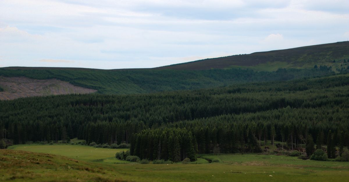
Before diving into individual products, it is worth understanding what makes this range genuinely unlike other UK camping destinations. The Cheviots are not a single dramatic peak but a sprawling, rounded uplift of ancient volcanic rock, roughly 40 km across, with the high ground running along the England–Scotland border. The summit of The Cheviot itself rises to 815 metres — modest by Alpine standards, but completely exposed, with no trees above the valley floors and few reliable water sources on the tops.
The Legal Situation: England vs Scotland
This is the detail most articles get wrong, and it is the one that matters most. The vast majority of the massif — including the summit of The Cheviot — sits inside England, within Northumberland National Park. England has no general right to wild camp, and the Dartmoor exception does not apply here. Strictly speaking, camping anywhere in the English section requires the landowner’s permission.
In practice, Northumberland National Park acknowledges that light-touch, leave-no-trace wild camping is tolerated in upper upland valleys and along the Pennine Way corridor, provided campers are discreet, pitch late, leave early and cause no damage. The park authority uses “responsible, low-impact” language in its guidance but issues no formal permit. That is the consensus across owner forums and the national park’s own published advice.
Here is the twist: the border runs along the ridge crest in several places, and the moment you pitch north of the boundary fence — near the valley heads around Kirk Yetholm or the College Valley — you are in Scotland, where the Land Reform (Scotland) Act 2003 and the Scottish Outdoor Access Code give a statutory right to wild camp on most unenclosed land. Experienced Cheviot campers deliberately route their overnight stops onto the Scottish side of the line for precisely this reason. The ridge fence near Kirk Yetholm and the College Valley heads marks the boundary — once you are north of it, the legal framework is entirely different.
Named locations worth targeting for legal Scottish-side pitches or routes well clear of MOD land include College Valley, Harthope Valley, The Schil approach, and Cocklawfoot. Each offers a different character of overnight stop, but all sit either on the Scottish side of the border or far enough from the military estate to avoid access complications.
The MOD Otterburn Complication
A large tract of the Cheviots to the south-east of the main massif falls within the MOD Otterburn Training Estate. This is active military land used for live-fire exercises, and on live-range days public access is closed entirely — not restricted, closed. Anyone routing through this area must check firing times at mod.uk before setting off. The training estate covers a substantial portion of the south-eastern Cheviots, and ignoring the firing schedule is not merely a trespass issue but a genuine safety concern.
Weather, Water and Terrain
The Met Office classifies the Cheviot summits as high, wind-exposed upland where cloud can sit on the tops for days and showers develop quickly. Valley forecasts routinely understate conditions on the ridge by several degrees and many knots of wind. For reliable planning, the Mountain Weather Information Service (MWIS) Cheviots/Borders forecast is the preferred source among experienced hillwalkers because it models summit-level conditions rather than relying on valley data.
Water on the Cheviots presents a dual problem. The upper slopes and tops are largely dry, meaning you may need to descend to find a burn or pool. When you do find water, it is often peat-stained and silty — which clogs filters rapidly — or, in the lower valleys near farmland, potentially contaminated with agricultural chemical runoff that standard filtration cannot address. This combination makes water treatment the single most consequential gear decision after shelter.
In summer, midges are a genuine issue from July through August in the valley floors, particularly near College Valley. They are less severe than in the north-west Highlands of Scotland, but present enough to make a midge net and appropriate clothing worth packing.
Shelter
MSR Hubba Hubba NX 2
Best for: Solo campers wanting maximum space and storm-worthiness, or two people sharing the load on a multi-day Pennine Way traverse.
The MSR Hubba Hubba NX 2 is a freestanding two-person tent that has earned a reputation as one of the most reliable lightweight shelters on the UK market. Its key structural advantage lies in the poles: MSR uses DAC Featherlight NSL aluminium poles rather than generic alloy. DAC Featherlight NSL is a proprietary pole system engineered for a high strength-to-weight ratio, with reinforced joints that resist splitting under wind loading — a critical factor on exposed Cheviot ridges where gusts funnel through the valleys with little warning.
The flysheet has a hydrostatic head (HH) of 1,500 mm, per MSR’s own specification. Hydrostatic head measures the column of water pressure a fabric can resist before leaking; 1,500 mm is the accepted minimum for general UK camping, though it is worth noting that Cheviot conditions — driving rain combined with persistent wind pressure — will test that figure over a multi-day trip. The inner tent is constructed from 68D ripstop nylon, a durable woven fabric that resists tearing on rough ground and provides reasonable breathability to manage condensation in the still, damp air of a peat-hag hollow.
The tent is freestanding, meaning the pole structure supports the pitch without requiring pegs — useful on the hard, rocky ground found near The Schil or on the summit plateau of The Cheviot itself, where pegging is difficult. Packed weight is approximately 1.79 kg, which is competitive for a two-person shelter with two doors and two vestibules, allowing both occupants to enter and exit independently and store wet gear separately from the sleeping area.
Standout strength: The DAC pole geometry and freestanding pitch make this the most storm-secure shelter in the shortlist for exposed, high-level Cheviot camps where the ground is too hard or too rocky for a peg-dependent design.
Caveat: At approximately 1.79 kg for a solo camper not sharing the load, it is heavier than purpose-built solo shelters — and the 1,500 mm flysheet HH, while adequate, sits at the lower end of what experienced UK hill campers prefer for multi-day exposure.
Verdict: The gold-standard lightweight two-person tent for Cheviot traverses where storm-worthiness matters more than shaving every last gram.
Where to buy: Typically stocked at Cotswold Outdoor and Trekitt, priced around £450–£500 at the time of writing.
Wild Country Zephyros 2
Best for: Budget-conscious campers or pairs tackling the Pennine Way section who want proven wind resistance without the premium price tag.
The Wild Country Zephyros 2 is frequently misclassified as a tunnel tent, but its correct designation is a semi-geodesic hoop tent — it uses two crossing hoops rather than a single continuous arch. That distinction matters because a semi-geodesic structure distributes wind load across two intersecting hoop points, giving better structural stability than a pure tunnel design where a single hoop failure can collapse the entire shelter. In Cheviot conditions, where wind direction can shift 180 degrees overnight as weather fronts rotate through, this structural redundancy is a genuine advantage.
The flysheet carries a hydrostatic head of 3,000 mm, per Terra Nova and Wild Country specifications — double the MSR’s figure and a substantial margin for the sustained, wind-driven rain that characterises Cheviot autumns. A 3,000 mm HH means the fabric can resist a three-metre column of water pressure before moisture penetrates, which provides real-world confidence on multi-day trips where the tent may be pitched wet and stay wet for 48 hours.
Packed weight is approximately 2.3 kg, making it roughly half a kilogram heavier than the MSR Hubba Hubba NX 2. That weight penalty is the trade-off for the lower price point and the heavier-duty flysheet fabric. The r/wildcampinguk community consensus is that the Zephyros 2 pitches fast in wind — a significant practical advantage when you are setting up in a Cheviot gale with numb fingers — and that vestibule drainage is adequate for the peat-bog conditions found throughout the Cheviot valleys, where ground water tends to pool rather than drain away naturally.
Standout strength: The combination of a 3,000 mm HH flysheet and semi-geodesic hoop structure at around £200–£250 makes this the best value storm-worthy shelter on the UK market for Cheviot use.
Caveat: At approximately 2.3 kg and with a taller profile than dedicated solo shelters, it is best justified when two people are sharing the load on a multi-day Pennine Way section — a solo camper would likely find the weight and packed bulk noticeable on the long, trackless approaches to Cheviot summit camps.
Verdict: Proven, affordable and storm-capable — the sensible choice if you want Cheviot-ready shelter without spending £450+.
Where to buy: Available at Webtogs and Cotswold Outdoor, typically priced around £200–£250.
Water Filtration
Sawyer Squeeze
Best for: Cheviot campers who need a lightweight, field-serviceable filter capable of handling the biological load found in upland burns and pools.
The Sawyer Squeeze uses a 0.1-micron absolute hollow-fibre membrane — meaning the internal pores are physically sized to 0.1 microns and independently certified to that standard by EPA and NSF testing protocols. A 0.1-micron absolute rating is fine enough to physically block bacteria (typically 0.5–5 microns) and protozoan cysts such as Cryptosporidium and Giardia (4–15 microns). This is the filtration standard relied upon by backpackers worldwide, and it is the reason the Squeeze is the most recommended filter in UK wild-camping communities.
However, there are two critical limitations that apply directly to Cheviot Hills wild camping, and both must be understood before relying on this filter.
First: the peat problem. Cheviot water, particularly in the upper valleys and around peat-hag complexes, is loaded with fine particulate organic matter. This silt will clog a hollow-fibre membrane almost instantly if untreated water is forced through it. Sawyer’s own guidance acknowledges that silty water reduces flow rate significantly. The solution is a mandatory pre-filtration step: collect water in a vessel, let it settle for 10–15 minutes so the heaviest sediment drops to the bottom, then pass the clearer upper water through a cloth or coffee filter before pouring it into the Sawyer Squeeze pouch. Without this step, a new filter can lose most of its flow rate within a single trip. With it, the filter remains serviceable for hundreds of litres.
Second: the agricultural runoff problem. The Sawyer Squeeze does not remove dissolved chemicals. In the lower Cheviot valleys, particularly where burns drain through improved farmland, there is a real risk of agricultural chemical runoff — fertilisers, herbicides and livestock treatments that dissolve into water and pass straight through any mechanical filter. The filter also does not remove dissolved tannins, which means peat-stained water will remain brown even after filtration. The colour is harmless, but the chemical contamination risk is not.
For this reason, anyone camping in the lower Cheviot valleys near farmland should carry Aquatabs (sodium dichloroisocyanurate tablets) as a chemical backup. Aquatabs are not a substitute for filtration — they address biological contamination but not chemical contamination either — but they provide a second layer of biological protection if the filter clogs or fails, and they are the standard UK hillwalking backup for water treatment. Aquatabs cost around £4–£6 per pack at most UK outdoor retailers, making them one of the cheapest insurance policies in a backpack.
Standout strength: The 0.1-micron absolute rating with EPA/NSF certification provides verified biological protection in a package weighing well under 100 g, and the hollow-fibre design can be backflushed in the field to restore flow.
Caveat: Without disciplined pre-filtration, Cheviot peat water will clog this filter rapidly, and no mechanical filter — including this one — can address the agricultural chemical runoff risk present in lower valley burns near farmland.
Verdict: The best lightweight filter for Cheviot use, but only when paired with a pre-filter routine and chemical backup for valley-floor water sources.
Where to buy: Widely available at UK outdoor retailers; approximately £40–£50.
Stove
Jetboil Stash
Best for: Fast-and-light Cheviot campers who prioritise boiled water for rehydrated meals and hot drinks over elaborate cooking.
The Jetboil Stash is an integrated stove system designed around speed and efficiency. Its packed weight is 100 g — a figure that includes the stove, pot, lid and stabilising stand — making it one of the lightest integrated systems on the market. For context, a standalone canister stove and titanium mug combination might weigh similar, but would lack the integrated heat exchanger that gives the Stash its efficiency advantage.
Jetboil’s laboratory figure for boil time is 2.5 minutes for 0.5 litres of water. This is a manufacturer-stated figure produced under controlled conditions, and real-world performance on a Cheviot ridge in a 30 mph wind will be slower. However, the integrated wind protection of the pot design means the Stash retains more of its efficiency in marginal conditions than an open-flame stove, where wind can extend boil times by 50 per cent or more.
The system uses standard Lindal-valve canisters — the threaded gas canisters sold at virtually every UK outdoor shop. In the Cheviots, this matters because resupply options are limited; the nearest significant outdoor retailers to the main trailheads are in Wooler and Jedburgh, so carrying a canister in and knowing it is compatible with widely available replacements is essential for multi-day trips. Blacks and Cotswold Outdoor both stock compatible Lindal-valve canisters.
Standout strength: At 100 g packed, the Stash delivers integrated-system boil efficiency at a weight that competes with bare-bones standalone stoves — ideal for Cheviot trips where every gram matters on the long approach walks.
Caveat: The Stash is optimised for boiling water, not simmering or frying, so campers who want to cook actual meals rather than rehydrate pouches will find its capabilities limited.
Verdict: The definitive fast-and-light stove for Cheviot wild camping, where hot water for rehydrated meals and a brew at the end of a wet day is all most campers need.
Where to buy: Widely available at UK outdoor retailers, including Blacks and Cotswold Outdoor.
Safety and Navigation
Garmin inReach Mini 2
Best for: Anyone camping in the Cheviots who wants two-way satellite communication and SOS capability in areas with no mobile signal.
The Cheviots have extensive signal blackspots, particularly on the high moorland between The Cheviot summit and the Scottish border ridge. A standard mobile phone is not a reliable safety tool in this landscape. The Garmin inReach Mini 2 is a satellite communicator that operates on the Iridium satellite network, providing global two-way text messaging, location sharing and an interactive SOS function that connects to a 24/7 emergency response coordination service.
Priced at around £350–£380 at Trekitt, the inReach Mini 2 represents a significant investment, but it addresses the single most important safety gap in Cheviot wild camping: the inability to call for help when the weather closes in and you are two valleys from the nearest road. The device pairs with a smartphone via Bluetooth, allowing you to type messages on the phone keyboard rather than the device’s limited interface, and it integrates with mapping apps so your planned route and location can be shared with a contact at home.
An alternative is a registered Personal Locator Beacon (PLB) — an EPIRB-style device that transmits a distress signal on the 406 MHz frequency to satellites monitored by search-and-rescue authorities. PLBs cost around £200–£250, also available at Trekitt, and have the advantage of no subscription fee (the inReach Mini 2 requires an active satellite plan). However, a PLB is a one-way emergency-only device — it sends an SOS and your location, but you cannot communicate the nature of the emergency or receive confirmation that help is coming. The inReach Mini 2’s two-way communication is a meaningful advantage in a Cheviot context, where the nature of an incident (lost in fog on the ridge vs. ankle injury in a valley) determines the appropriate rescue response.
Standout strength: Two-way satellite messaging means you can describe your situation to rescuers and receive confirmation — a capability a basic PLB cannot match, and one that matters in the complex terrain of the Cheviots where rescue teams need specific location and condition information.
Caveat: Requires an active subscription plan on top of the purchase price, making the total cost of ownership higher than a no-fee PLB over a multi-year period.
Verdict: The most capable safety device for Cheviot wild camping, worth the premium for anyone who camps solo or ventures into the more remote valley heads and border ridge.
Where to buy: Available at Trekitt, priced around £350–£380.
Navigation Essentials: Maps and Forecasts
No amount of digital technology replaces the two non-negotiable navigation tools for the Cheviots: a physical map and a summit-specific weather forecast.
OS Explorer OL16 (The Cheviot Hills) is the definitive paper map for the range, covering the entire massif at 1:25,000 scale — the level of detail needed to navigate pathless moorland, identify field boundaries (including the border fence line) and locate bothy ruins and water sources. A physical copy is non-negotiable because the Cheviots’ signal blackspots mean digital mapping on a phone can fail at exactly the moment you need it most — in cloud, on a featureless plateau, with a phone battery depleted by cold. Carry the map in a waterproof case, know how to take a bearing with a compass, and keep the phone as a backup rather than a primary tool.
For weather, the MWIS Cheviots/Borders forecast is the preferred source. MWIS — the Mountain Weather Information Service — produces forecasts specifically for hillwalkers, modelling summit-level conditions rather than the valley data that dominates Met Office outputs. The difference matters: a Met Office forecast for Wooler might show 12°C and light winds, while the MWIS Cheviots forecast reveals 4°C on the summit with 40 mph gusts and a wind-chill well below freezing. Always check MWIS the night before and the morning of your trip.
Mountain Rescue: Northumberland National Park MRT
In the event of an incident, the Northumberland National Park Mountain Rescue Team is the named contact for Cheviot Hills emergencies. If you are using a satellite communicator or PLB, the SOS signal will be routed through the appropriate coordination centre, which will task the local mountain rescue team. If you have phone signal, dialling 999 and asking for Police then Mountain Rescue is the standard UK protocol. Knowing the name of the local team — Northumberland National Park MRT — is useful when providing information to emergency services, particularly if you are calling from a borderline area where the Scottish Borders MRT might also be relevant.
Frequently Asked Questions
Is wild camping legal in the Cheviot Hills?
It depends which side of the border you are on. The English side — including The Cheviot summit at 815 m — has no statutory right to wild camp; Northumberland National Park guidance uses “responsible, low-impact” language and tolerates discreet, leave-no-trace camping without issuing formal permits. The Scottish side, north of the ridge fence near Kirk Yetholm and the College Valley heads, is covered by the Land Reform (Scotland) Act 2003 and the Scottish Outdoor Access Code, which gives a statutory right to wild camp on most unenclosed land.
Do I need a permit to wild camp in the Cheviots?
No permit is required, but on the English side camping is tolerance-based rather than legally permitted. The national park authority does not issue permits; instead, it expects campers to follow leave-no-trace principles — pitch late, leave early, camp well away from roads and settlements, and cause no damage to vegetation or archaeology. On the Scottish side, no permit is needed because the right to camp is statutory under the Land Reform (Scotland) Act 2003.
How do I check MOD Otterburn firing times?
Check the MOD website at mod.uk before routing through the Otterburn Training Estate, which covers a large tract south-east of the main Cheviot massif. On live-range days, public access to the training estate is closed entirely — not restricted, closed. Firing schedules are published in advance, but they can change, so it is worth checking both before you set off and the evening before your trip. Routing around the training estate is straightforward if you plan ahead; routing through it on a live-fire day is both illegal and dangerous.
Are midges a problem in the Cheviots?
Midges are a genuine issue from July through August, particularly in the valley floors near College Valley and other sheltered, damp areas. They are less severe than in the north-west Highlands of Scotland, but present enough to make a midge head net and long sleeves worth carrying during peak season. On the exposed ridges and summits, wind keeps midges grounded, so the problem is largely confined to valley-floor pitches and still evenings.
Can I drink the water from Cheviot streams and burns?
Water from Cheviot upland burns can be made safe to drink with a 0.1-micron filter such as the Sawyer Squeeze, which removes bacteria and protozoa. However, peat-laden water must be allowed to settle for 10–15 minutes and pre-filtered through cloth or a coffee filter before passing through the Squeeze, or the fine silt will clog the membrane rapidly. In the lower valleys near farmland, agricultural chemical runoff is a real risk that no mechanical filter can address — carry Aquatabs (around £4–£6 per pack) as a biological backup, and avoid drawing water from burns that drain directly through improved pasture where possible.
What map should I carry for the Cheviot Hills?
OS Explorer OL16 (The Cheviot Hills) at 1:25,000 scale is the definitive paper map for the range. A physical copy is non-negotiable because the Cheviots have extensive mobile signal blackspots, particularly on the high moorland and summit plateaus. Digital mapping on a phone is useful as a supplement, but battery life, cold-weather performance and signal reliability all make a phone an unreliable primary navigation tool in this landscape. Carry a compass alongside the map and know how to take a bearing.
Which weather forecast should I use for the Cheviots?
The MWIS (Mountain Weather Information Service) Cheviots/Borders forecast is the preferred source for hillwalkers because it models summit-level conditions rather than valley data. The Met Office provides useful background information, but valley forecasts routinely understate wind speeds and overstate temperatures for the exposed ridge and summit areas. Check MWIS the night before your trip and again on the morning of departure, as Cheviot weather can change rapidly.