Yorkshire Dales Wild Camping Map: Where It Works and the Rules
Where wild camping is tolerated in the Yorkshire Dales, the legal position, an area-by-area guide, and the limestone and access issues to know.
Yorkshire Dales Wild Camping Map: Where It Works and the Rules
The Yorkshire Dales offers some of the most distinctive wild camping in England — broad limestone uplands, the Three Peaks, and long stretches of the Pennine Way where you can walk all evening without meeting anyone. It also has particular quirks, because limestone country behaves differently from the Lakes or the Peak. This guide is based on desk research: National Park Authority guidance, Ordnance Survey mapping and published walking sources rather than first-hand testing. Below you will find the legal position, an area-by-area breakdown, and the practical issues limestone creates.
Quick Reference
| Area | Suitability | Notes |
|---|---|---|
| High fell above the intake wall | Generally tolerated if discreet | The usual English convention applies |
| Three Peaks summits and paths | Avoid | Heavy erosion, high footfall, active repair work |
| Valley floors, meadows, riverbanks | Not tolerated | Hay meadows and farmland; some are protected habitat |
The Legal Position
As everywhere in England outside Dartmoor’s specific arrangements, there is no legal right to wild camp in the Yorkshire Dales. The Countryside and Rights of Way Act 2000 gives a right of access on foot to mapped open access land, but camping is explicitly excluded, so pitching without the landowner’s permission is a civil trespass.
What operates instead is the same informal tolerance found in the Lakes: discreet, high, one-night camping that leaves no trace is generally accepted by landowners, while anything visible, low-lying or lingering is not. The National Park Authority’s published guidance is that wild camping requires the landowner’s permission.
Two Dales-specific points sharpen this:
Hay meadows. The Dales retains some of the best surviving traditional upland hay meadows in Britain, many protected as Sites of Special Scientific Interest. They look like inviting flat grass in June. Camping on them is genuinely damaging and will earn you a justifiably furious farmer. Stay off enclosed meadow land entirely.
Working farms everywhere. Dales farming is marginal and the drystone wall and field barn landscape is actively maintained at real cost. Climbing walls, leaving gates and disturbing stock cause direct financial harm.
The Limestone Problem
This is what makes the Dales different, and it catches people out.
Water disappears. Limestone is soluble, so rain sinks through it rather than running off. Large areas of the high ground — Ingleborough, Fountains Fell, Malham High Country — have almost no surface water at all, even after heavy rain. Streams marked on the map may be dry, and beck lines vanish into swallow holes.
Practically: carry all the water you need, or plan a route that passes a reliable source. Do not assume you can top up on the tops. Where you do find water on limestone, it has often passed through fissures with sheep above, so treat it.
The ground is holed. Limestone pavement, shakeholes, potholes and open shafts are everywhere on the uplands, some of them very deep and many partly hidden by vegetation. Pitching in the dark on unfamiliar ground is a genuinely bad idea here in a way it is not on a grassy fell. Arrive with enough light to see where you are putting the tent.
Limestone pavement is protected. Those distinctive fissured slabs — clints and grikes — are a rare habitat and most are covered by Limestone Pavement Orders. Do not camp on them, and do not move the rocks.
Area by Area
Ingleborough, Whernside and Pen-y-ghent (the Three Peaks). Spectacular, and the most heavily used ground in the park. The main Three Peaks route suffers severe erosion and is subject to ongoing, expensive path repair. Camping on or near the summits and the main path corridor adds to a problem the park is actively fighting — camp elsewhere. If you want a Three Peaks view, pitch on quieter ground to the side and walk in.
Mallerstang and the high ground above Wild Boar Fell. Quiet, broad, high, and among the better options in the park. Wild Boar Fell and Swarth Fell hold good ground away from paths, with genuine remoteness by Dales standards.
Great Shunner Fell and the Pennine Way corridor. The Pennine Way crosses the park north to south and passes a great deal of empty high ground. Long-distance walkers camp discreetly along it as a matter of routine. Peaty in places, so pick your pitch.
Baugh Fell and the Howgills. The Howgills — smooth, steep, grassy whalebacks — were brought within the enlarged park boundary and are excellent for wild camping: little rock, plenty of flat ground high up, and few people. Note there is more surface water here than on the limestone, because the Howgills are older, less soluble rock. If water is your concern, this is the area to head for.
Upper Swaledale and Arkengarthdale. Beautiful and quiet, but heavily worked by lead mining historically. The ground is full of spoil heaps, shafts, levels and ruined smelt mills — archaeologically important and physically dangerous. Camp on clean ground away from workings, and do not enter any opening.
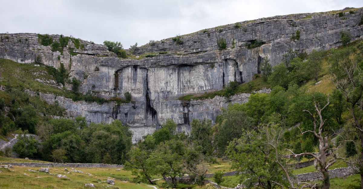
Malham. The Cove and Tarn are among the busiest honeypots in northern England, and the limestone pavement above the Cove is protected. Walk well beyond before considering a pitch.
The Rules
- Above the intake wall, high, out of sight of roads, houses and paths.
- Arrive late, leave early. One or two tents, one night.
- No fires. Peat on the higher moors and dry grass in summer; use a stove.
- Never on hay meadows, limestone pavement or archaeology.
- Carry all rubbish out. Everything.
- Human waste 30m from water, 15cm deep, all paper carried out. Note that on limestone, waste buried near a fissure can reach the groundwater system quickly — move well away from any grike or shakehole.
- Dogs on leads near stock. Lambing runs roughly February to May.
- Move on politely if asked.
Practical Notes
- Water is the planning constraint. Work out where you will fill up before you set off, and carry more than feels necessary on the limestone tops.
- Wind. The Dales uplands are broad and exposed, with little natural shelter. A tent that handles wind matters more than one rated for cold.
- Maps. OS Explorer OL2 (Yorkshire Dales Southern & Western) and OL30 (Northern & Central) cover most of it.
- Navigation. Broad, featureless plateaux in cloud — Fountains Fell, Baugh Fell, the Howgill tops — need real compass work. Shakeholes make wandering off route in poor visibility genuinely hazardous.
- Access land closures. Open access land can be closed for up to 28 days a year plus for fire risk and management. Check before relying on a route.
- Public transport. The Settle–Carlisle railway runs right through the park with stations at Settle, Horton-in-Ribblesdale, Ribblehead, Dent and Garsdale — one of the best car-free wild camping approaches in England.
FAQ
Is wild camping allowed in the Yorkshire Dales? Not as a legal right. Like the rest of England outside Dartmoor’s particular arrangements, the Countryside and Rights of Way Act grants access on foot to open access land but specifically excludes camping, so pitching without permission is trespass. In practice, discreet high-level camping above the intake wall that leaves no trace is generally tolerated. Camping on valley floors, hay meadows or near the Three Peaks honeypots is not, and the Dales has particularly sensitive habitat at low level.
Where is the best wild camping in the Yorkshire Dales? The Howgills are the standout — smooth grassy fells with plenty of flat high ground, few visitors, and, unusually for the park, reliable surface water because they are not limestone. Mallerstang and Wild Boar Fell are similarly quiet. The Pennine Way corridor across Great Shunner Fell offers plenty of discreet ground. Avoid the Three Peaks route and Malham, which are the busiest and most erosion-damaged areas.
Why is water so scarce on the Yorkshire Dales tops? Because much of the high ground is limestone, which is soluble. Rain sinks through fissures and swallow holes rather than running off as surface streams, so becks marked on the map can be completely dry even after heavy rain, and large areas of Ingleborough and Fountains Fell have no reliable water at all. Plan your route around known sources, carry more than you think you need, and treat anything you do collect — it has usually passed through grazed ground.
Are there specific hazards in the Dales I should know about? Two. First, the limestone uplands are riddled with shakeholes, potholes and open shafts, many partly hidden by vegetation — so arrive with enough daylight to see your pitch, and take navigation in poor visibility seriously. Second, Swaledale and Arkengarthdale are full of former lead-mining workings: spoil heaps, levels and shafts that are both archaeologically protected and physically dangerous. Camp on clean ground and never enter an opening.